busy California highway.

This computer rendering

shows what the completed

pathway might look like.BRIDGE TO SAFETY

Animals like cougars will

benefit from a new wildlife

crossing, now under

construction across this

busy California highway.

This computer rendering

shows what the completed

pathway might look like.

ILLUSTRATION BY ALLAN DAVEY

STANDARDS

NGSS: Core Idea: ETS2.B, ESS2.C, ESS2.D

CCSS: Reading Informational Text: 2

TEKS: 6.4A, 7.4A, 8.4A, ESS4.B

Finding Shackleton's Ship

An Antarctic expedition searches for a lost piece of history at the bottom of the sea

AS YOU READ, THINK ABOUT the tools scientists use to search for objects on the ocean floor. 

Last February, a ship called the Agulhas II sailed to the Weddell Sea off the coast of Antarctica. A thick layer of sea ice surrounded the ship on all sides. But the scientists, engineers, and archaeologists aboard the research vessel weren’t worried about getting stuck in the frozen waters. The crew was much more concerned about what lay far beneath the ocean’s icy surface.

For weeks, the researchers had been using robotic undersea drones to scour the seafloor. They were looking for the wreck of another ship: the Endurance (see Key Moments: Antarctic Exploration). The vessel sank more than 100 years ago, and its exact location had remained a mystery ever since. For members of the search expedition, dubbed Endurance22, the hunt for the lost ship would turn out to be the most challenging—and rewarding—mission of their lives.

Last February, a ship called the Agulhas II set sail. It traveled to the Weddell Sea off the coast of Antarctica. A thick layer of sea ice surrounded the ship. Scientists, engineers, and archaeologists were aboard the research vessel. But they weren’t worried about getting stuck in the frozen waters. They were much more concerned about something else. It lay far beneath the ocean’s icy surface.

For weeks, the researchers searched the seafloor with robotic undersea drones. They were looking for the wreck of another ship. It was the Endurance (see Key Moments: Antarctic Exploration). The vessel sank more than 100 years ago. Since then, its exact location had remained a mystery. The search expedition was named Endurance22. For its members, the hunt for the lost ship would be the most challenging mission of their lives. It would also be the most rewarding.

FRANK HURLEY/SCOTT POLAR RESEARCH INSTITUTE, UNIVERSITY OF CAMBRIDGE/GETTY IMAGES

ABOARD THE ENDURANCE: Crew members pose on the ship’s deck.

A HISTORIC VOYAGE

ROYAL GEOGRAPHICAL SOCIETY VIA GETTY IMAGES

LEGENDARY EXPLORER: Ernest Shackleton

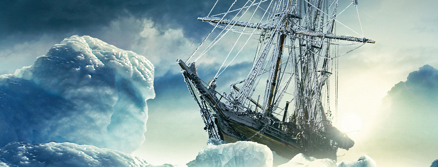
In December 1914, famed British explorer Sir Ernest Shackleton set off for Antarctica aboard the Endurance with a crew of 27 men. They wanted to be the first people to trek across the continent of Antarctica. Before they could attempt this feat, they met with disaster. The Endurance became trapped in sea ice (see Shackleton’s Journey).

Shackleton and his crew drifted for the next 10 months as their ice-lodged ship was carried by ocean currents. The shifting ice tore holes in the vessel and slowly crushed its sides. Eventually, the ship began taking on water, and the men had to abandon it and make camp on the surrounding ice floes. On November 21, 1915, the Endurance finally sank.

Using the ship’s lifeboats, the men sailed to the uninhabited Elephant Island. With little hope of rescue there, Shackleton and five others set out for a fishing station on another island, named South Georgia. It was nearly 1,300 kilometers (800 miles) northeast across the open sea. Their small lifeboat offered little protection against the storms, rough waves and freezing waters of the Southern Ocean.

In December 1914, famous British explorer Sir Ernest Shackleton set off for Antarctica. He sailed aboard the Endurance with a crew of 27 men. They wanted to be the first people to trek across Antarctica. Before they could try, disaster struck. The Endurance became trapped in sea ice (see Shackleton’s Journey).

Ocean currents carried the ice-lodged ship. Shackleton and his crew drifted for the next 10 months. The ice shifted. It tore holes in the vessel and slowly crushed its sides. Eventually, the ship began taking on water. The men had to leave it and camp on the surrounding ice floes. On November 21, 1915, the Endurance finally sank.

The men used the ship’s lifeboats. They sailed to the uninhabited Elephant Island. But they had little hope of rescue there. So Shackleton and five others headed for a fishing station on another island, named South Georgia. It was nearly 1,300 kilometers (800 miles) northeast across the open sea. They’d face the storms, rough waves, and freezing waters of the Southern Ocean. And their small lifeboat offered little protection.

FRANK HURLEY/SCOTT POLAR RESEARCH INSTITUTE, UNIVERSITY OF CAMBRIDGE/GETTY IMAGES

FROZEN CAMP: Shackleton and his crew camped for months on the ice after the Endurance sank in late 1915.

In the early 1900s, sailors determined their position at sea using instruments to measure the angle of stars or the sun from the horizon. Then they compared this information to navigation charts to pinpoint their location on the water. But cloudy weather prevented Shackleton and his men from taking these readings. They had to determine their position by estimating how fast, how far, and in what direction they’d traveled. If they missed South Georgia, they would end up drifting helplessly in the ocean.

After a perilous journey that lasted 17 days, the group made it to the island. Shackleton trekked to a whale-hunting station. A fishing boat carried him and his companions to Chile. There, the Chilean navy loaned them a ship to rescue the other men, who had been stranded for 127 days. Miraculously, Shackleton and his entire crew made it home alive. “It’s the most amazing story of survival,” says John Shears, leader of the Endurance22 expedition.

In the early 1900s, sailors used instruments to find their position at sea. These instruments measured the angle of stars or the sun from the horizon. Then the sailors compared this information to navigation charts. That told them their location on the water. But the weather was cloudy, so Shackleton and his men couldn’t take these readings. They had to find their position another way. They figured how fast, how far, and in what direction they’d traveled. If they missed South Georgia, they would drift helplessly in the ocean.

The dangerous journey lasted 17 days. Finally, the group reached the island. Shackleton trekked to a whale-hunting station. A fishing boat carried him and his men to Chile. There, the Chilean navy lent them a ship. They sailed off to rescue the other men, who had been stranded for 127 days. It seemed impossible, but Shackleton and his entire crew made it home alive. “It’s the most amazing story of survival,” says John Shears, leader of the Endurance22 expedition.

THE SEARCH

Shackleton died suddenly in 1922, at the age of 47. To mark the 100th anniversary of his death, the Endurance22 expedition team set out to find the final resting place of his famous ship. The group based its search for the Endurance on notes from the 1914 expedition. “Historic diaries and logbooks gave us a good idea of approximately where it had sunk,” says Shears.

The team divided the search area, about 380 square km (150 square mi) of ocean, into a grid. Then they used autonomous underwater drones that could explore with minimal human oversight to examine each section
of the grid.

Shackleton died suddenly in 1922. He was 47 years old. The Endurance22 expedition would mark the 100th anniversary of his death. The team set out to find the final resting place of his famous ship. To plan their search, the group used notes from the 1914 expedition. “Historic diaries and logbooks gave us a good idea of approximately where it had sunk,” says Shears.

The search area was about 380 square km (150 square mi) of ocean. The team divided it into a grid. Then they used autonomous underwater drones to cover each part of the grid. These drones could explore with little help from humans.

JAMES BLAKE AND FALKLANDS MARITIME HERITAGE TRUST 

NEW EXPEDITION: The icebreaker Agulhas II set out in February 2022 in search of the wreck of the Endurance.

Searching in such frigid waters posed unique challenges. “The ice was the biggest obstacle,” says Nico Vincent, who led the expedition’s underwater team. Some of the sea ice covering the search grid was about 2 meters (6.6 feet) thick. As a polar icebreaker, the Agulhas II was designed to break through ice floes. But any open water created by the ship quickly refroze. The ship had to keep its propellers running to prevent ice from forming and make sure an opening remained for a drone to resurface.

Searching in freezing waters posed its own challenges. “The ice was the biggest obstacle,” says Nico Vincent, who led the expedition’s underwater team. Sea ice covered the search grid. Some of it was about 2 meters (6.6 feet) thick. The Agulhas II is a polar icebreaker. It was designed to break through ice floes. But when the ship created open water, the water quickly refroze. The ship kept its propellers running to prevent ice from forming. It had to maintain an opening for a drone to resurface.

ESTHER HORVATH/FALKLANDS MARITIME HERITAGE TRUST

UNDERWATER ROBOT The 2022 expedition used undersea drones to search for the wreck of the Endurance.

Each drone was tethered to the ship by a fiber-optic cable. It allowed the drone to transmit data and be manually controlled by a pilot if necessary. “In Antarctica, you have to be ready for the unexpected,” explains Vincent.

The drones mapped the seafloor using sonar—a device that sends out sound waves to detect objects. “The seabed there is very flat,” says Vincent. “So anything out of the ordinary would be hard to miss.”

Each drone was connected to the ship by a fiber-optic cable. The drone could send data through the cable. And a pilot could control the drone if necessary. “In Antarctica, you have to be ready for the unexpected,” explains Vincent. The drones mapped the seafloor with sonar. This device sends out sound waves to detect objects. “The seabed there is very flat,” says Vincent. “So anything out of the ordinary would be hard to miss.”

AMAZING FIND

On March 5, 2022, a drone’s sonar picked up something unusual: a large object 3,008 m (9,868 ft) below the surface. The team took a closer look with the drone’s high-resolution camera. It was the wreck of a ship, nearly perfectly preserved. Boots, mugs, and other artifacts could be seen on the deck. “It looked as if it sank yesterday,” says Vincent.

When the drone turned its camera to the wreck’s stern, the name Endurance was clearly visible. They had found Shackleton’s lost ship! “It was an incredible moment,” says Shears. “I was too overwhelmed to speak.”

On March 5, 2022, a drone’s sonar picked up something unusual. A large object lay 3,008 m (9,868 ft) below the surface. The team looked closer with the drone’s high-resolution camera. It was the wreck of a ship, nearly perfectly preserved. They could see boots, mugs, and other artifacts on the deck. “It looked as if it sank yesterday,” says Vincent.

Then the drone turned its camera to the wreck’s stern. The name Endurance was clearly seen. They had found Shackleton’s lost ship! “It was an incredible moment,” says Shears. “I was too overwhelmed to speak.”

© FALKLANDS MARITIME HERITAGE TRUST

FOUND SHIP: The Endurance’s wheel is visible on the rear deck in this underwater photo.

The discovery of the historic wreck was Endurance22’s crowning achievement. But the expedition had scientific importance, too. Because of the Weddell Sea’s remote location, few scientists have had the chance to study its seafloor. That makes the data collected on this trip extremely valuable. “No one had ever surveyed the Weddell Sea at this kind of resolution before,” explains Shears.

The Endurance has been declared a historical site and monument, so nothing can be touched or removed. Instead, engineers took tens of thousands of high-resolution photos and videos of the wreck for scientists to study. They also took 3-D scans, which can be used to build a detailed computer model of the ship. “We hope someday you’ll be able to walk the decks of the Endurance with virtual reality glasses,” says Vincent.

The discovery of the historic wreck was Endurance22’s greatest feat. But the expedition was important to science too. The Weddell Sea is remote, and few scientists get a chance to study its seafloor. So the data from this trip is extremely valuable. “No one had ever surveyed the Weddell Sea at this kind of resolution before,” explains Shears.

The Endurance has been declared a historic site and monument. Nothing can be touched or removed. Instead, engineers took tens of thousands of high-resolution photos and videos of the wreck. Now scientists can study them. They also took 3-D scans. These can be used to build a detailed computer model of the ship. “We hope someday you’ll be able to walk the decks of the Endurance with virtual reality glasses,” says Vincent. 

COMMUNICATING INFORMATION: What were some of the challenges researchers faced in searching for the wreck of the Endurance?

videos (1)
Skills Sheets (4)
Skills Sheets (4)
Skills Sheets (4)
Skills Sheets (4)
Lesson Plan (2)
Lesson Plan (2)
Text-to-Speech